Every field,every season,every tractor.

Marshal Fields is the farm manager for agricultural operations: fields and land, crops and plantings, seasons, field activities, equipment, inventory and finances — with a web back-office for the office and an Android app for the people in the field.
  • Field boundaries drawn on the map
  • GPS-tracked walks and work sessions
  • Two-factor sign-in
fields.marshal.co.ls/soil-testing
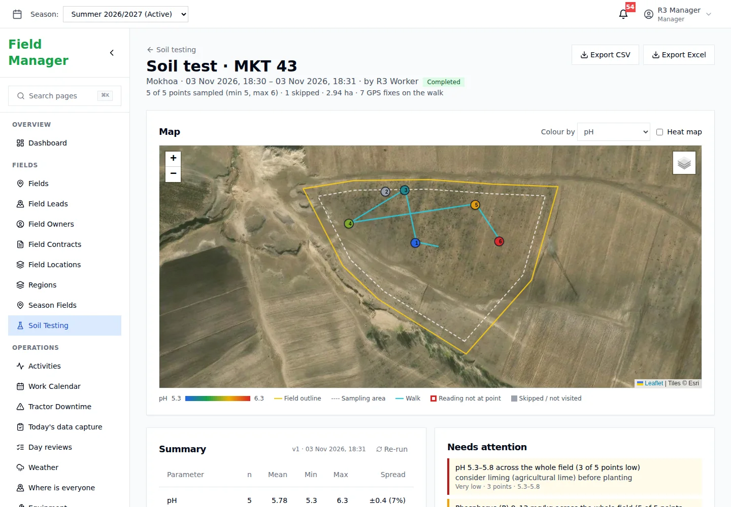
Marshal Fields soil test session showing the field boundary on a satellite map with sampling points

One farming season

  1. Winter

    Every field is drawn on the map, with its owner and contract.
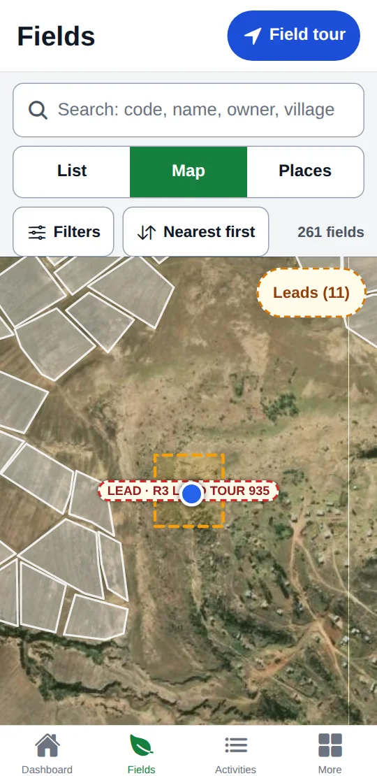
    Every field is drawn on the map, with its owner and contract.
  2. Pre-season

    Soil is tested point by point, walked on a phone.
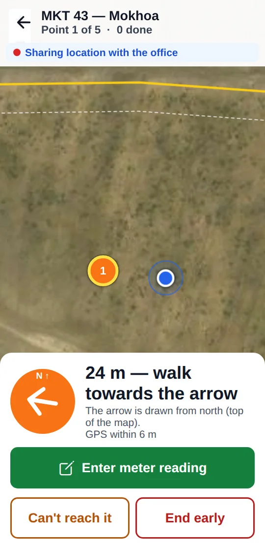
    Soil is tested point by point, walked on a phone.
  3. Planting

    Tractors log their work. The slow fields stand out.
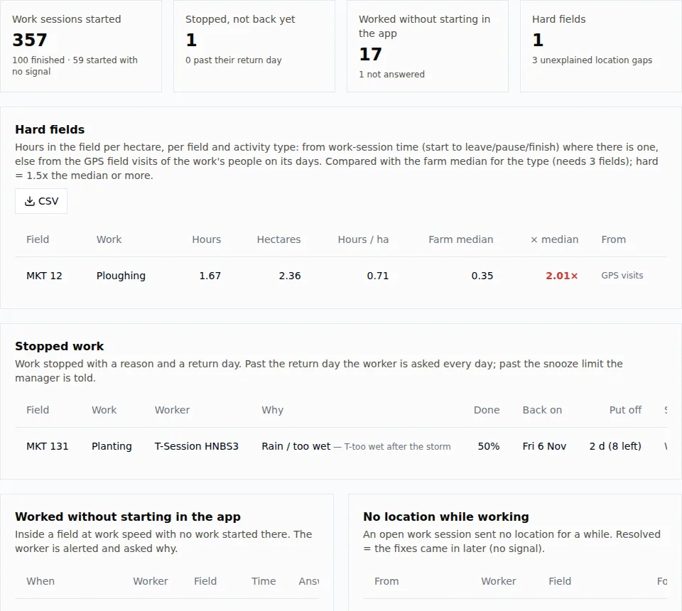
    Tractors log their work. The slow fields stand out.
  4. Mid-season

    Someone is asked to check a field, and you know they did.
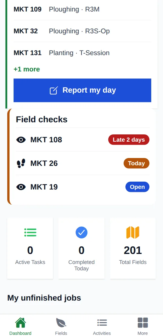
    Someone is asked to check a field, and you know they did.
  5. Harvest

    Next season's land is already in the pipeline.
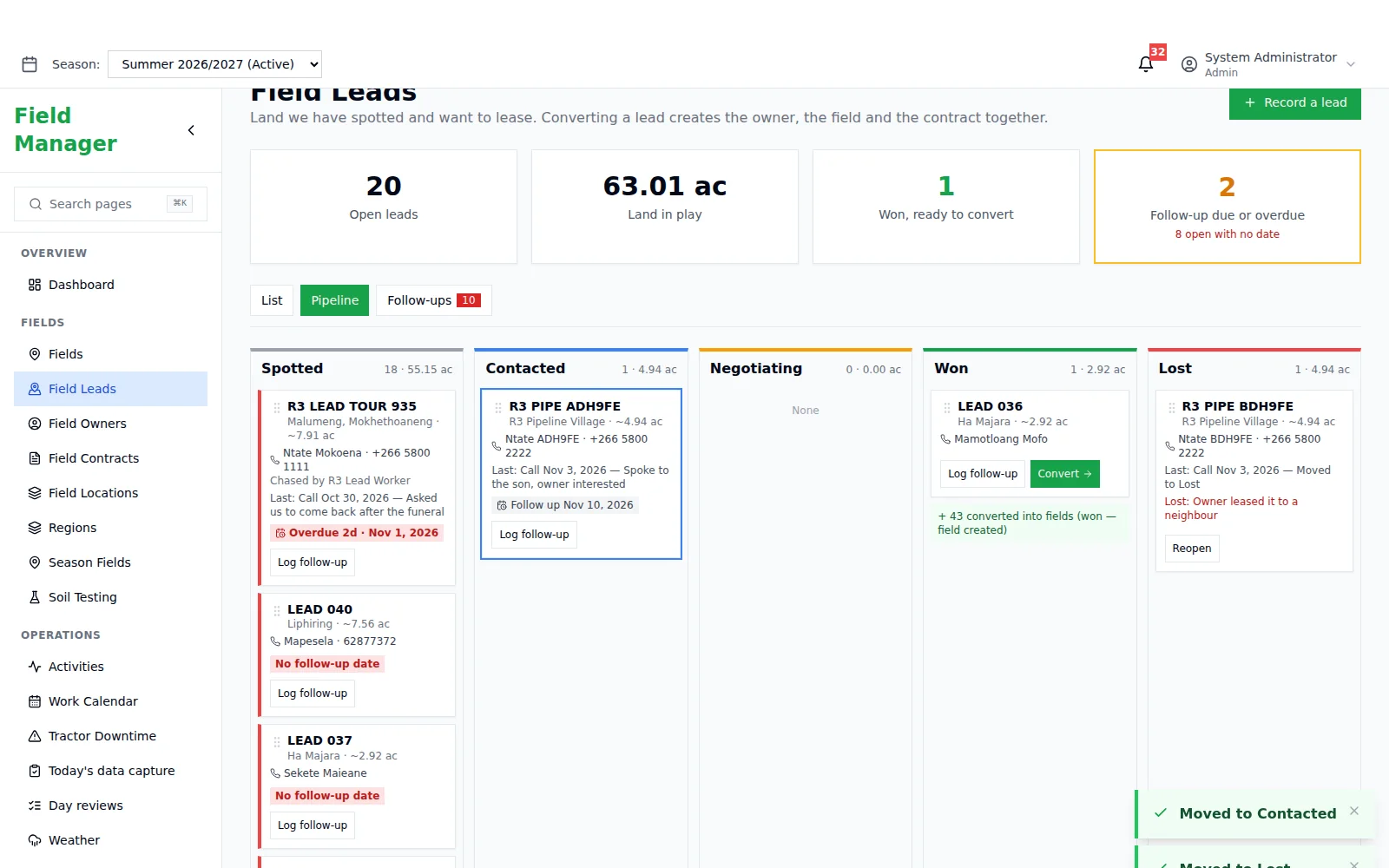
    Next season's land is already in the pipeline.

Fields, crops, seasons, tractors and teams — from the office map to the worker in the field.

3 roles: admin, manager and field worker
2 apps, one record: web back-office and Android
1 map with every field, owner and contract

From the office map to the worker standing in the field.

  1. Fields & land

    Every field drawn on the map, with its owner and contract.

    Field boundaries drawn on a map with automatic hectare calculation, field owners, procurement contracts with share percentages, GPS field locations and regions.
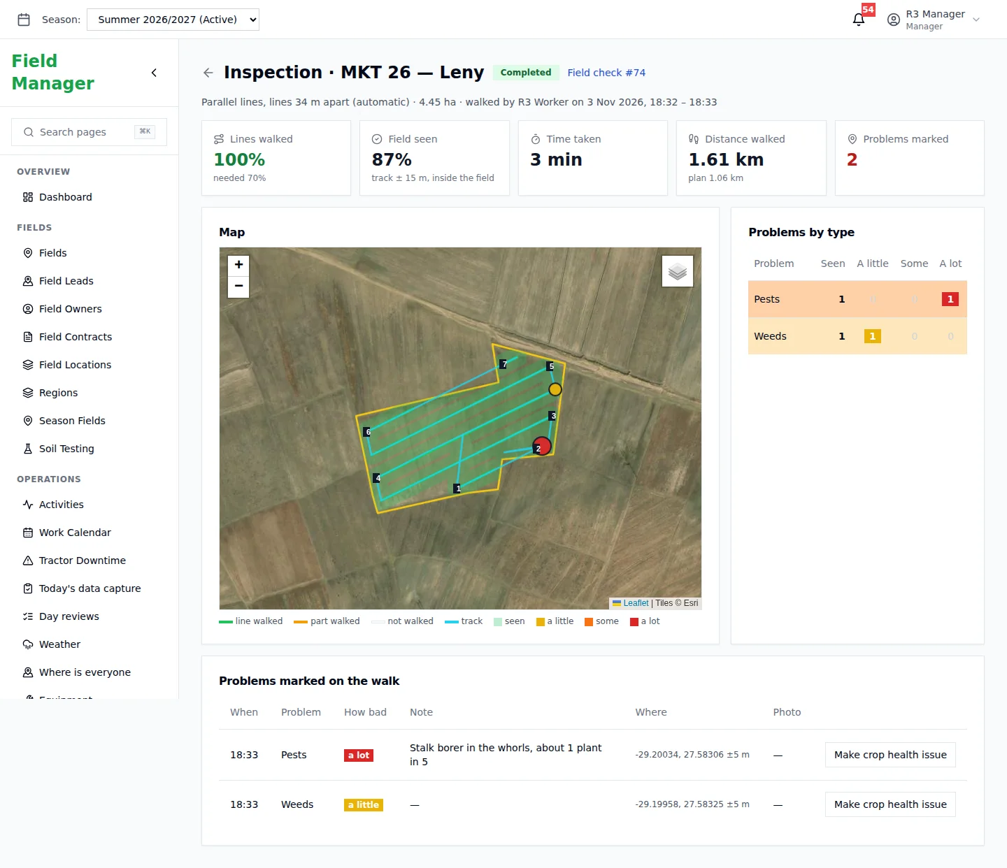
    • Boundaries with automatic hectares
    • Owners and contracts with shares
    • Regions and GPS locations
    fields.marshal.co.ls/inspections
    Fields: Fields & land
  2. Field checks

    Ask someone to go and look — and know they did.

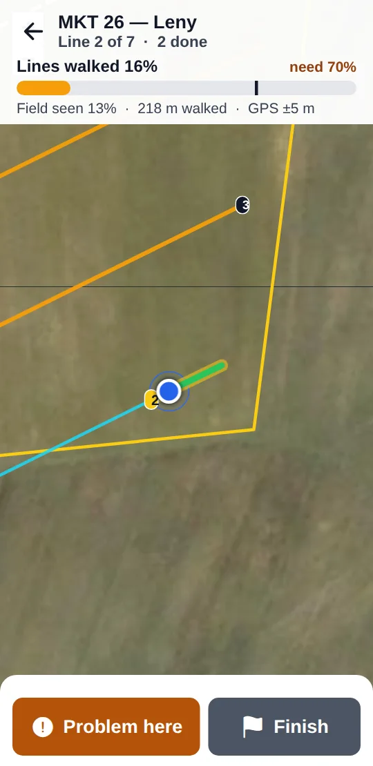
    Schedule quick or thorough checks. The walk is tracked by GPS, problems are marked where they're found, and the report only counts when the phone was at the field.
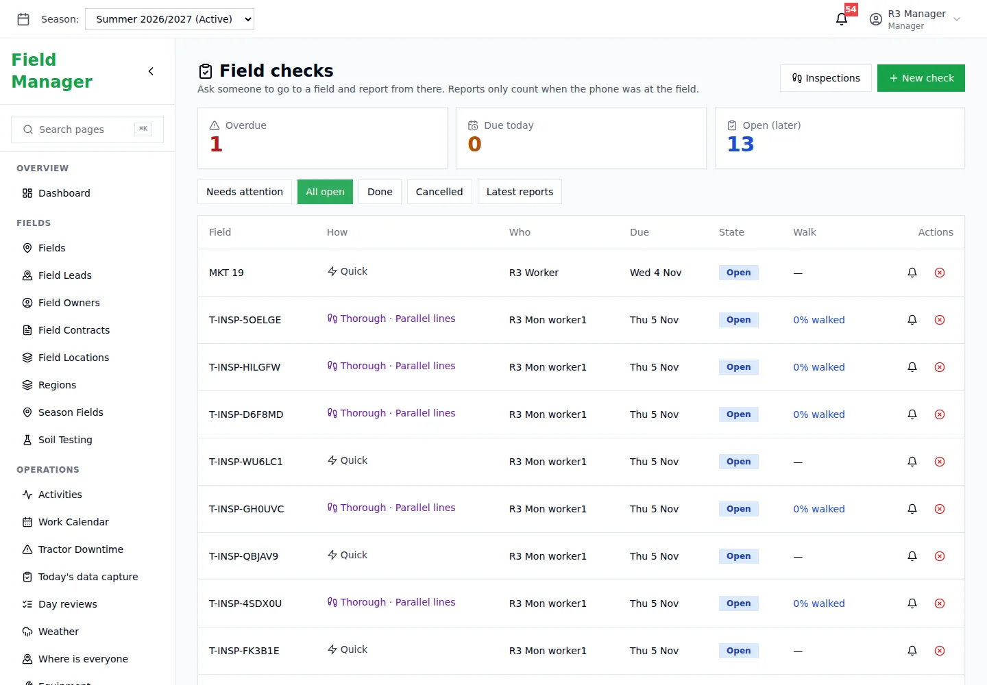
    • Quick and thorough checks
    • Lines walked and field seen
    • Problems pinned on the map
    fields.marshal.co.ls/field-checks
    Fields: Field checks
  3. Soil testing

    Plan the test, walk the points, get the plan.

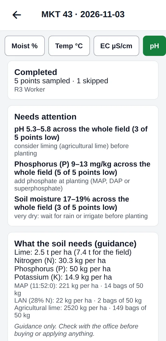
    Plan soil tests per field and see every reading — moisture, temperature, EC and pH — with what needs attention and a lime and fertiliser plan as guidance.
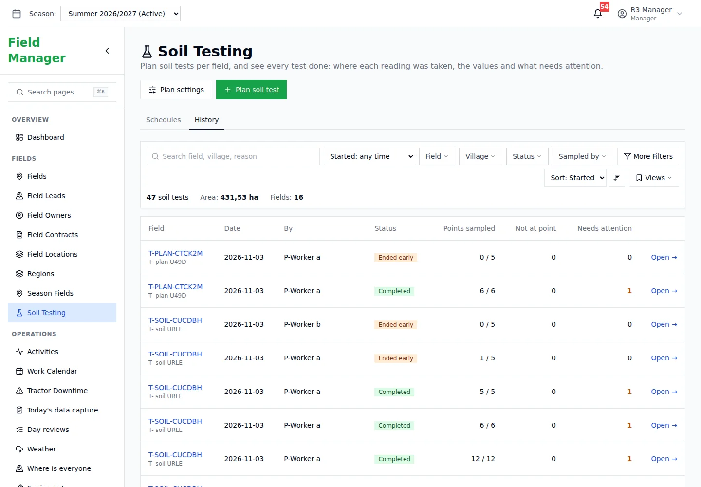
    • Sampling points walked by arrow
    • Readings per point
    • Lime and fertiliser guidance
    fields.marshal.co.ls/soil-testing
    Fields: Soil testing
  4. Work sessions

    What each tractor did today — and the fields that ran slow.

    Workers start work at a field, log fuel, problems and expenses, and close the day. Hours per hectare are compared with the farm's median, and stopped work comes back with a reason.

    • Start work at a field
    • Hard fields flagged against the median
    • Close-the-day per tractor
    fields.marshal.co.ls/reports/sessions
    Fields: Work sessions
  5. Land leads

    Land you want, from spotted to signed.

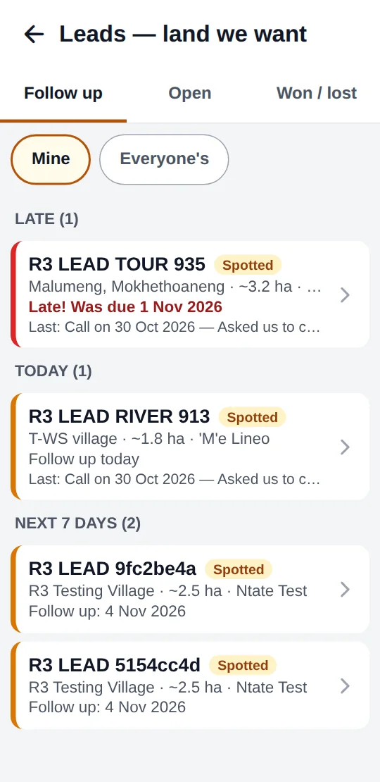
    Record land you've spotted and want to lease. Follow-ups, a pipeline from Spotted to Won, and converting a lead creates the owner, the field and the contract together.

    • Spotted → Contacted → Negotiating → Won
    • Follow-up dates that nag
    • Convert creates owner, field and contract
    fields.marshal.co.ls/field-leads
    Fields: Land leads

An app built for gloves, sun and one bar of signal.

Field workers get the day's jobs, the weather, the map and a big green button. Everything they record lands in the back-office.
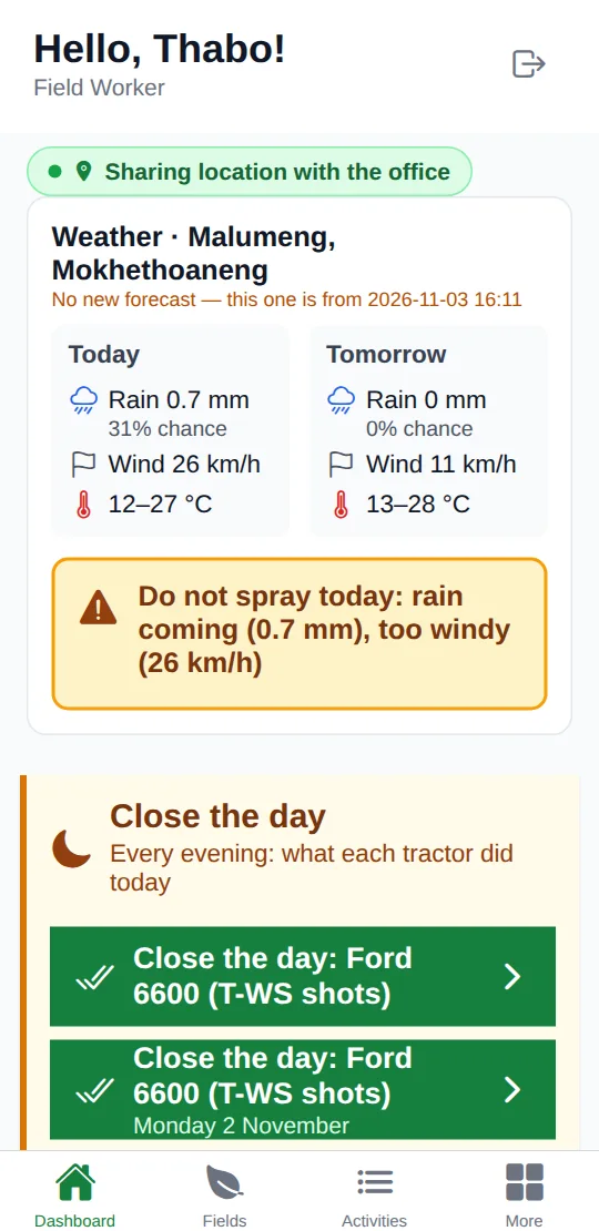
Every morning: Weather, today's jobs and a warning when it's too windy to spray.
Every morningWeather, today's jobs and a warning when it's too windy to spray.
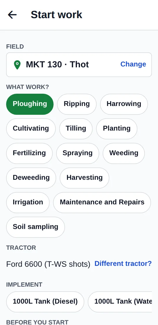
Starting work: Pick the field, the work, the tractor and the implement.
Starting workPick the field, the work, the tractor and the implement.
The map: Every field nearby, with leads marked on the satellite view.
The mapEvery field nearby, with leads marked on the satellite view.
Field checks: Walk the lines; the app tracks how much of the field was seen.
Field checksWalk the lines; the app tracks how much of the field was seen.
Soil testing: An arrow walks you to each sampling point.
Soil testingAn arrow walks you to each sampling point.
Results: What needs attention, and what the soil needs.
ResultsWhat needs attention, and what the soil needs.
Land leads: Follow-ups due today, late or coming up.
Land leadsFollow-ups due today, late or coming up.

The back-office behind the farm.

Seasons

Seasons thread through activities, expenses, income, fuel and usage logs, with a default season per user.

Crops & plantings

Crop catalog, crop health and issue tracking, planned plantings and approval flows for updates.

Equipment & fuel

Tractors with fuel logs, part tracking and downtime.

Inventory

Items, stock transactions and usage logs against fields and activities.

Finance

Expenses by vendor, category and equipment; income with customers, invoices and payment status.

Notifications

In-app and push notifications, with WhatsApp Business and email integrations.

Asked before you sign up

Does the app work for field workers?

Yes. Field staff use the Android app for their jobs, checks, soil tests and work sessions; managers use the web back-office.

How are fields recorded?

Boundaries are drawn on a map and hectares are calculated automatically. Each field links to its owner, contract and region.

Is it secure?

Role-based access for admins, managers and field workers, per-user permissions, two-factor sign-in and an audit history with recoverable deletes.

How do we get started?

Talk to us. We'll set up your farm, import your fields and get your team on the app.

Run the farm from one map.

Tell us about your fields and your team, and we'll show you Marshal Fields on your own land.